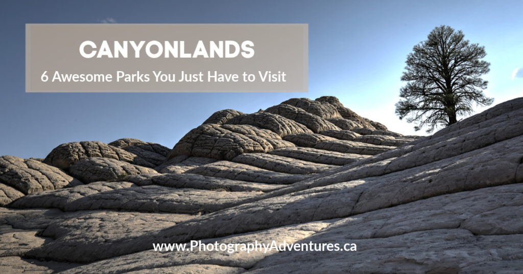
Travels to the America West Canyons: A Photo Adventure
I can leave the big cities behind anytime! The top attractions you need to visit in the USA are the National Parks, especially the American West Canyon area. These parks give you a chance to get back to nature, explore the wilderness, and gaze up at pristine night skies. The western United States has a multitude of National Parks, and each one is distinct and unique – but for this adventure, I’m going to take you to Valley of Fire State Park – Nevada, Zion National Park – Utah, Bryce Canyon National Park – Utah, Coral Pink Sand Dunes State Park – Utah, Horseshoe Bend – Arizona.
So, in this American West Canyon photo adventure travel guide, we will take you to some very special places, share with you tips on how to photograph these sites and the best ways to get there. All photos were taken with my Canon EOS 6D camera using my 3-favourite lens – EF-16-35mm F/4L IS USM / EF-24-105mm f/4L IS USM / EF-70-200mm f/2.8L IS USM.
Hope you enjoy the photos!
Valley of Fire State Park
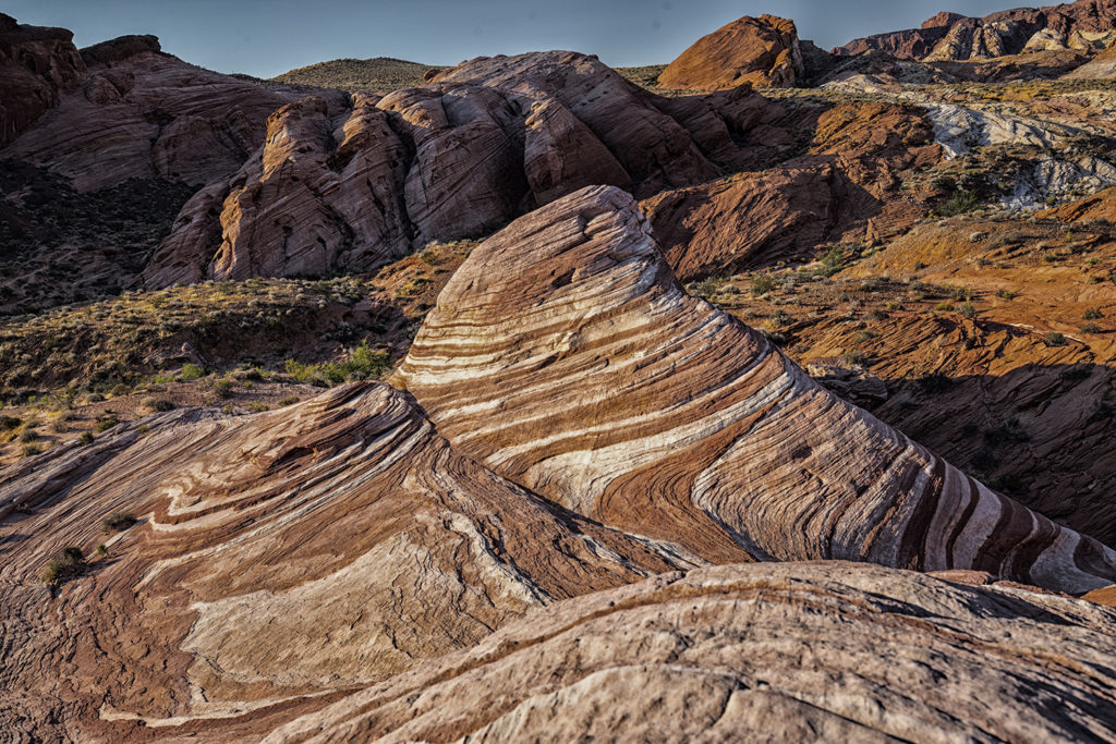
The Fire Wave
Valley of Fire State Park is a little-known gem of amazing sandstone only 50 miles from Las Vegas. We started our Canyon lands tour here. Early in the morning we left Vegas to catch the sunrise over the valley. The Fire Wave is quickly becoming an icon of the American West. This photo was taken with my Canon EF-16-35mm lens; in AV mode; at f/8 with an ISO setting of 100 in tripod.
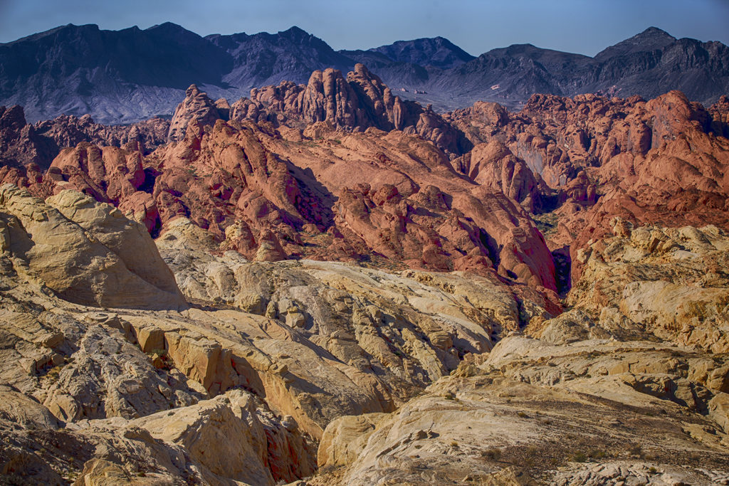
The Wild & Rugged Valley of Fire
The best time to visit the Valley of Fire State Park is in spring and fall. You can get there from Las Vegas in only 1-hour drive. We went in September and decided to they hike to the Fire Wave early in the morning to avoid the hot sun – glad we brought lots of water – you’ll really need it on the hike. This photo of the “Rugged Valley” was taken with my Canon EF-70-200mm lens; in AV mode; at f/8 with an ISO setting of 100 in a tripod.
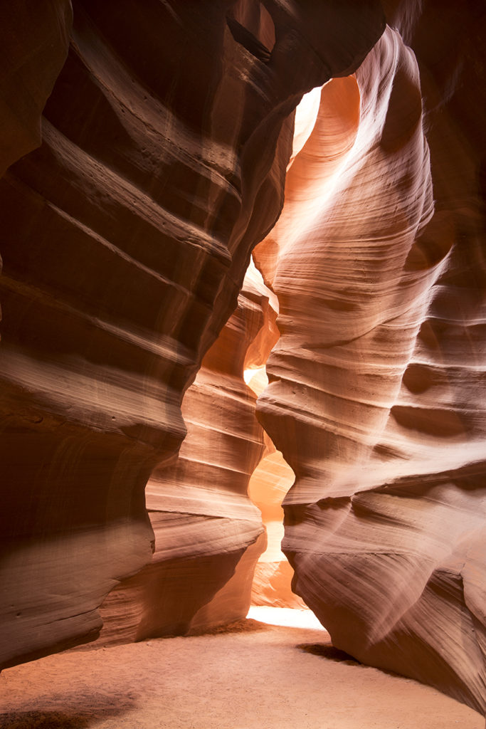
Antelope Canyon
The Dancing Flame
Antelope Canyon is a scenic slot canyon on Navajo land just east of Page, Arizona. Rainwater during monsoon season, runs into the extensive basin above the slot canyon sections, picking up speed and sand as it rushes into the narrow passageways. Over time the passageways eroded away, making the corridors deeper and smoothing hard edges in such a way as to form characteristic “flowing” shapes in the rock. Truly a photographer’s dreamland. TIP – take the photographers tour, otherwise you will have masses of people crowded into the slots and it will be impossible to get these kinds of photos above. The photo tour guide makes sure there are no people in the canyon when you photograph. Also a tripod is needed because of the low lighting condition. This photo of the “Dancing Flame” was taken with my Canon EF-16-35mm lens; in AV mode; at f/9 with an ISO setting of 320 in a tripod.
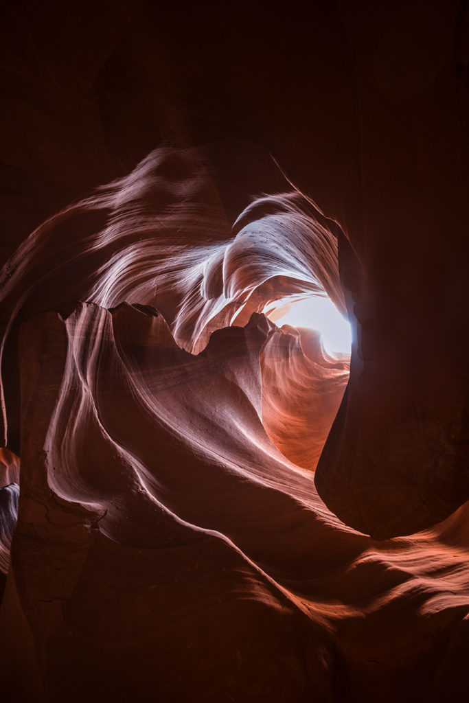
The heart of Antelope Canyon
Deep inside Antelope Canyon cavern slots, there’s lies the heart of Antelope canyon – but you must look up high to see it. (Once again a photo tour guide was helpful in pointing out the many canyon features). This photo of the “Heart of Antelope Canyon” was taken with my Canon EF-16-35mm lens; in AV mode; at f/9 with an ISO setting of 320 in a tripod.
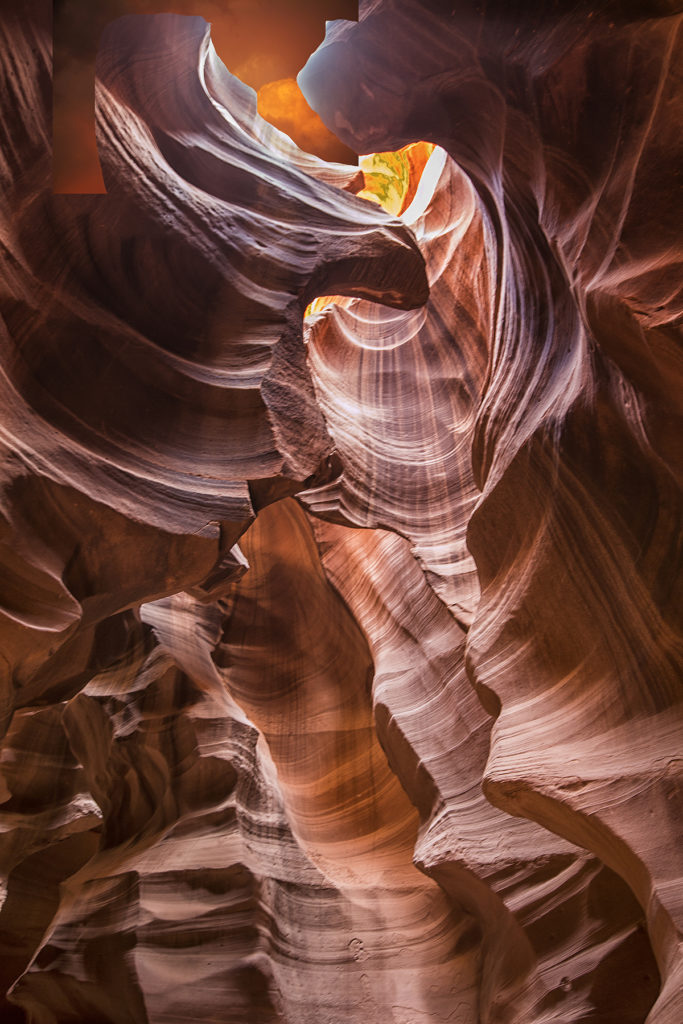
Patterns of Nature
Beautiful abstract patterns of nature abound everywhere you look in the Upper & Lower Antelope Canyon. We only had a chance to do the upper canyon on this trip, but if you are able to climb, then the lower canyon is also interesting. If you stare long enough you will see shapes of animals and all kind of things… This photo of the “Patterns of Nature” was taken with my Canon EF-16-35mm lens; in AV mode; at f/9 with an ISO setting of 320 in a tripod.
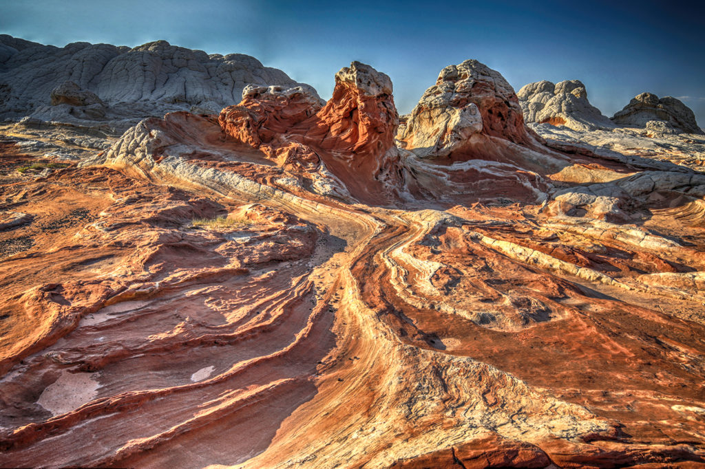
White Pocket, Arizona
Brain Rocks, White Pocket, Arizona
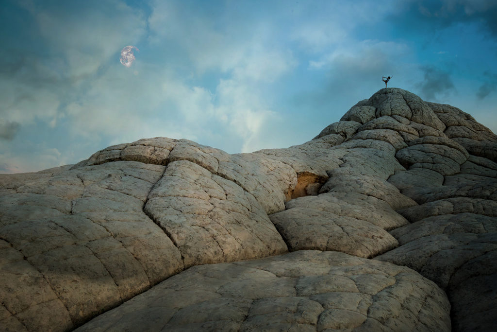
Located deep in the Sand Hills in the Vermillion Cliffs National Monument, White Pocket is remote area and requires a good 4WD vehicle to reach this destination. We were bounced up & down and all around for a 1-hour drive, but I think the gruelling trip was worth the photos. (What we won’t do for a good photo 🙂 White Pocket is like entering a fantasy landscape on an alien planet. Some think that the area was liquefied in an ancient earthquake, which distorted the sandstone layers while they were still soft, before they were buried under the oceans for 100 million years and turned to stone under the enormous heat and pressure. These could in fact be sections of some enormous central cortex for the brain. This photo was taken just after sunset, when the cloud formation above the rocks was really interesting and a young girl was practising her yoga poses. This photo of the “Brain Rocks” was taken with my Canon EF-16-35mm lens; in AV mode; f/16 sec with an ISO setting of 4000 in a tripod.
White Pocket Moonscape
This photo of the “White Pocket Moonscape” was taken with my Canon EF-16-35mm lens; in TV mode; 1/40 sec with an ISO setting of 500 in a tripod.
White Pocket Twilight Tree
There are many places in the southwestern United States that you just can’t describe in words — they are hidden gems and absolutely wonderful and even weird at times – like this rock at White Pocket. This photo of the “White Pocket Twilight Tree” was taken with my Canon EF-16-35mm lens; in AV mode; f/11 with an ISO setting of 100 lying down on my back.
White Pocket Moonscape #2
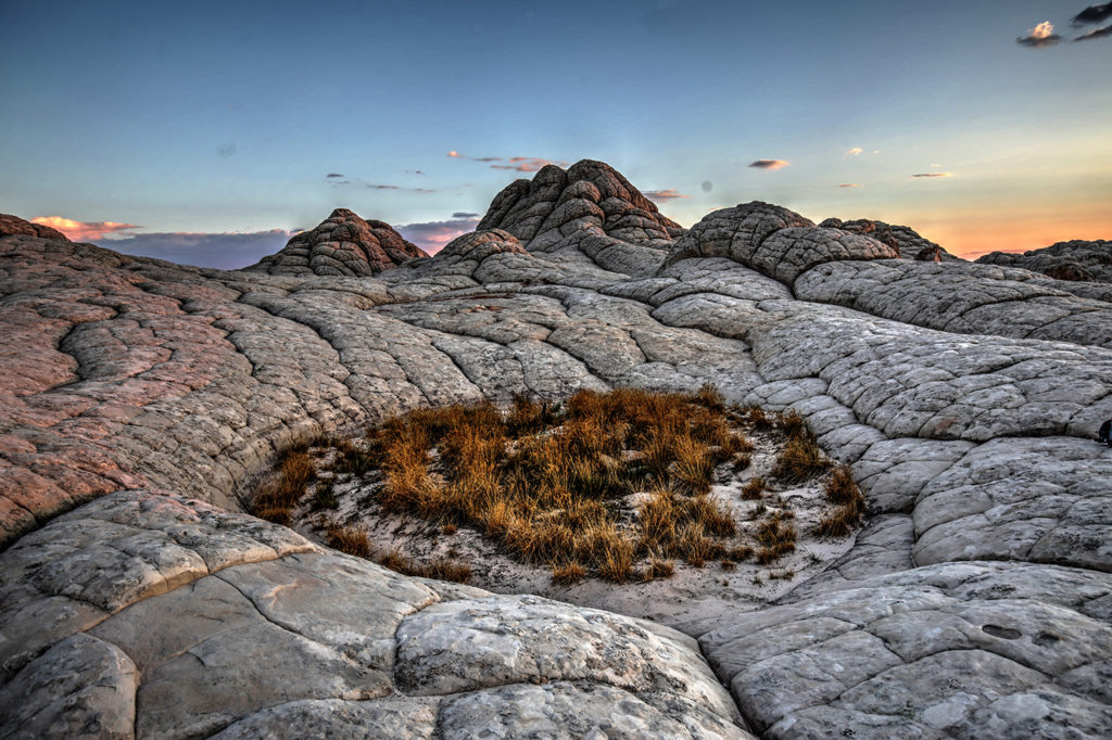
The brain rocks area at White Pocket is so amazing with the outcropping of white rock plopped in the sand of the Coyote Buttes area in Paria Canyon of Utah. Every direction you look – there is a fantastic photo opportunity. This photo of the “White Pocket Moonscape #2”was taken with my Canon EF-16-35mm lens; in AV mode; f/11 with an ISO setting of 100.
Bryce Canyon National Park
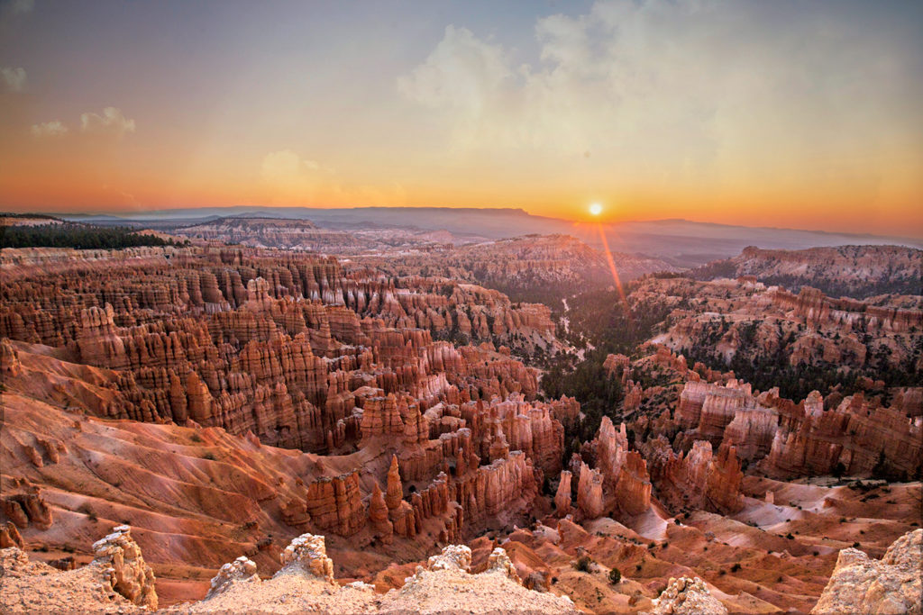
Sunrise Over Bryce Canyon
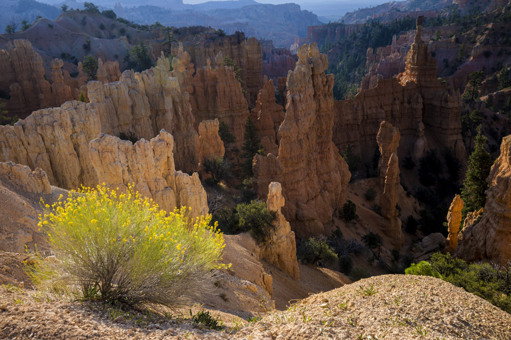
Bryce Canyon National Park is located in southwestern Utah. The major feature of the park is Bryce Canyon, which despite its name is not a canyon, but a collection of giant geological structures called hoodoos, which are the product of the destructive powers of water and time. The canyon is one of the best places on the planet to observe the forces that shape the surface of our earth. Bryce Canyon is a photographer’s paradise of striking landscapes and dynamic light. The hoodoos of Bryce Canyon’s main amphitheatre are spectacular in the morning glow of sunrise. This photo of the “Sunrise Over Bryce Canyon” was taken with my Canon EF-16-35mm lens; in AV mode; f/9 with an ISO setting of 100 on tripod.
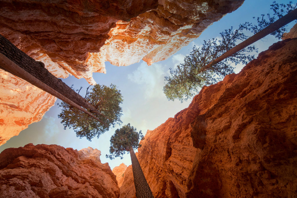
Reaching for the Sun
When you hike down Wall St. you will find the following trio of pine trees next to one of the enormous Bryce hoodoo walls. Makes you feel kind of small besides these gorgeous trees. This photo of the “Reaching for the Sun” was taken with my Canon EF-16-35mm lens; in AV mode; f/13 with an ISO setting of 640.
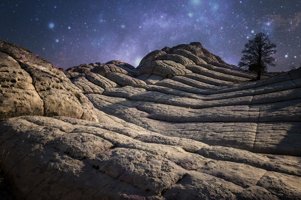
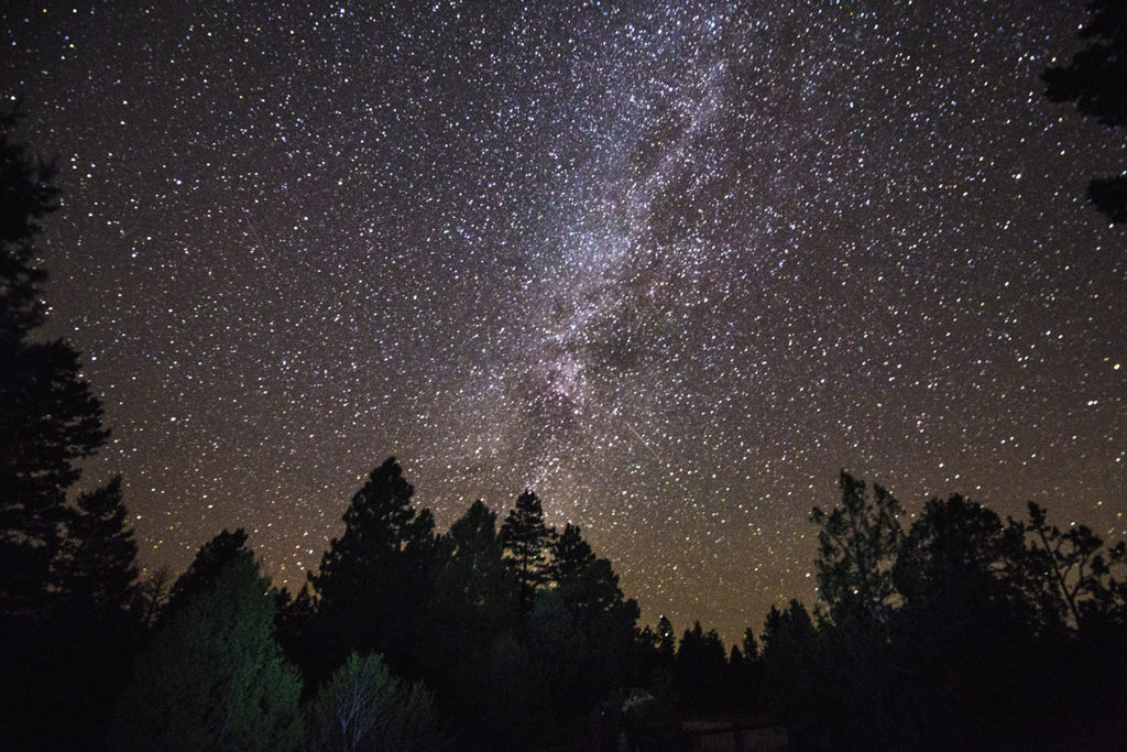
Milky Way Over Bryce Canyon
Bryce Canyon is the ultimate place to enjoy the splendour of the night sky. Far from the light pollution of civilization, I stood out here at 4am in the morning hoping I wouldn’t get eaten’ up by a grizzly bear or coyote – but I survived to tell the tale. This photo of the “Milky Way Over Bryce Canyon” was taken with my Canon EF-16-35mm lens; in manual mode; 30 sec; f/4 with an ISO setting of 8000 on tripod.
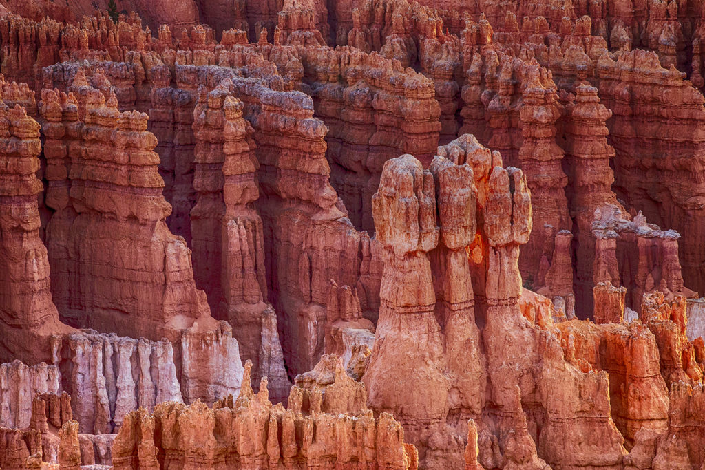
Hoodoos of Bryce Canyon
Hoodoos of Bryce Canyon are tall, thin spires of rock with hooded tops and are situated in the High Plateaus region of the Colorado Plateau in Utah. It’s the biggest cluster of these unusual-looking geological features anywhere in the world. This photo of the “Hoodoos of Bryce Canyon” was taken with my Canon EF-70-200mm lens; in AV mode; f/9 with an ISO setting of 1250 on tripod.
Fairyland Point Bryce Canyon
Rising 8,073 feet above the Fairyland Canyon floor, I was able to capture this view of this canyon, which resembles a Dr. Seuss Artscape gone to stone. Formations rise from the cactus-strewn landscape like earthen citadels. Hoodoos form where soft rock, like sandstone, is covered in a thin layer of harder rock. Weathering processes then erode these rocks into the pinnacles that we see today. Magical photographic moments. This photo was taken with my Canon EF-16-35mm lens; in AV mode; f/11 with an ISO setting of 100 on tripod.
Horseshoe Bend
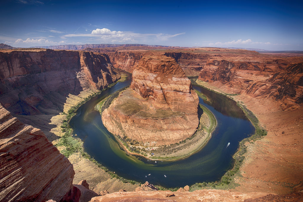
Horseshoe Bend
Horseshoe Bend in Arizona has offered astonishing views for centuries. It’s where the Colorado River makes a 270-degree turn at the bottom of a 700-foot-deep canyon and it’s quickly becoming an iconic image that represents the Grand Canyon in many visitors’ minds. This is truly one of the Southwest’s “small wonders” near the beginning of Grand Canyon National Park. Hiking to the Horseshoe Bend overlook is relatively quick and easy. You can park your car close by and hike down the trail. It was a bit scary taking this photo and you need to be very careful. There is no railing and people have fallen over the edge. I literally had my tripod 2 inches from the edge, using a wide-angle lens in order to capture this image. This photo was taken with my Canon EF-16-35mm lens; in AV mode; f/11 with an ISO setting of 100 on tripod.
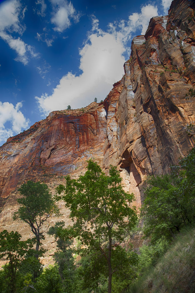
Zion National Park
Zion Mountains
Zion National Park is a southwest Utah nature preserve distinguished by Zion Canyon’s steep red cliffs. Rising in Utah’s high plateau country, the Virgin River carves its way to the desert below through a gorge so deep and narrow that sunlight rarely penetrates to the bottom. As the canyon widens, the river runs past great palisade walls rimmed with slick rock peaks and hanging valleys. This photo “Zion Mountains“ was taken with my Canon EF-24-105mm lens; in AV mode; f/11 with an ISO setting of 320.
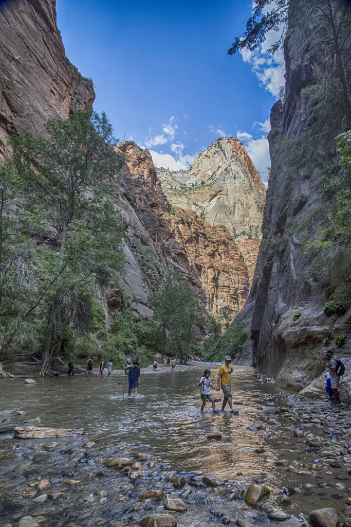
The Narrows
The Narrows is the narrowest section of Zion Canyon and is probably one of the most legendary canyons to hike in all of Zion National Park – so I just had to go there J Here, the majestic walls of the main canyon close in on you from both sides to form a tall and narrow canyon with beautiful dark corners and the Virgin River flowing around you as you hike up the river. You will be hiking in knee-deep water most of the time and it gets more challenging the future you go down the stream. Permits are needed if you hike sixteen miles downstream over one or two days. This photo “The Narrows“ was taken with my Canon EF-24-105mm lens; in AV mode; f/14 with an ISO setting of 320.
If you enjoyed this post on the Canyon lands – you’ll love our FREE e-book offer below
Here’s your chance to get your exclusive travel guide and photo tips in our 20 page e-book, along with regular travel tips delivered directly to your inbox.
Discover amazing places to visit and how to photograph them (for non techie people)
With over 300,000 readers, TripAdvisor has hailed us as being “In the Top 1% of Popular Reviewers” plus “Top Photographer” – having visited over “90 Cities” – so here are our TOP 5 places to visit before it’s too late!