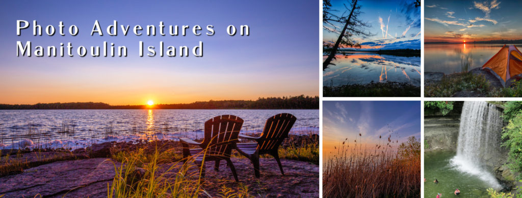
Located in northern Ontario, Manitoulin Island is the world’s largest fresh water island and features more than a hundred small inland lakes. The name Manitoulin means “Spirit Island” or “cave of the spirit” in Ojibwe, referring to an underwater cave in the local lore.
From Toronto, it’s just over a six-hour drive if you drive around Lake Huron and come in from the northern side of the island. Alternatively, you can drive your car onto the Chi-Cheemaun Ferry at Tobermory and get over to the island in a relaxed way. This is a fun way to get over to the island. There’s so much more to see and do on this beautiful island and we hope that this may inspire you to go for a visit.
Bruce Peninsula – Tobermory
Some call Tobermory and the surrounding area as the 8th Wonder of Canada. With its 1,000-year-old pine trees and pristine clear turquoise waters, you’ll see why they call it a wonder. There is so much to explore and do in this small town and surrounding areas, that you’ll need a week to take it all in. From the tip of the Bruce Peninsula, you can catch the ferry to Manitoulin Island. This photo was taken with a 16-35mm lens; in AV mode; at f/9 with an ISO setting of 400; exposure was 1/160 sec.
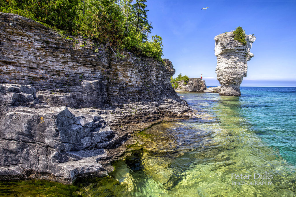
Flowerpot Island
Allow yourself some extra time in Tobermory and take the boat cruise out to Flowerpot Island. This island can only be accessed by boat and two hours is sufficient for a quick walk around the Island, but three to four hours is required if you want to see it all. It is part of Fathom Five National Marine Park. The island is famous for it’s two rock pillars or sea stacks called the “Flowerpots” on its eastern shoreline. This photo was taken with a 16-35mm lens; in AV mode; at f/11 with an ISO setting of 100; shutter speed of 1/80 sec.
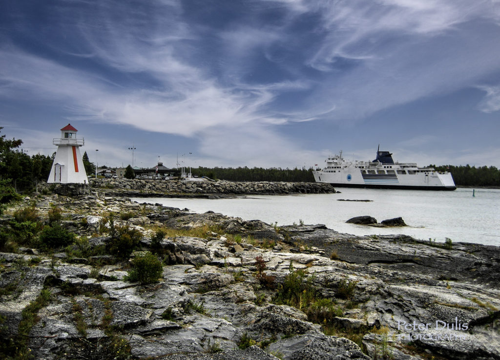
South Bay Mouth
The history of South Baymouth (where the ferry docks) is bound up with the history of fishing along the south shore of Manitoulin. There is a beautiful winding boardwalk that takes you beside a wetland where frogs, ducks, minnows and other aquatic life can be observed. Take the bridge across a narrow channel to a small island and you will find the lighthouse and a gazebo with a beautiful panoramic view of Lake Huron where the ferry comes in. This photo was taken with my Canon SD600 camera; at f/2.8 with an ISO setting of 82; exposure was 1/400 sec.
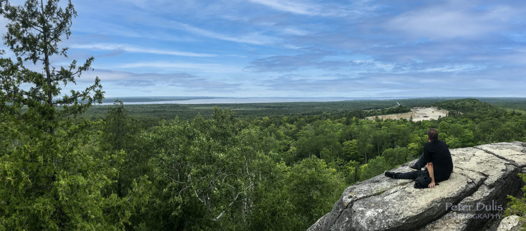
Cup & Saucer Hiking Trail near M’chigeeng
The Cup and Saucer Trail is one of the most popular hiking trails on Manitoulin Island, about 37-minutes from the ferry dock. With over 12 km of hiking trails, you have a wide selection of trails from easy to difficult. It’s the highest point on Manitoulin Island with cliffs as high as 70 meters, which give you a great view of the forests and lakes below. The trail is actually part of the famous Niagara Escarpment system of trails that houses some of the oldest forest eco-systems in eastern North America. This photo was taken with my iPhone at f/1.8 with an ISO setting of 20; shutter speed of 1/2500 sec.
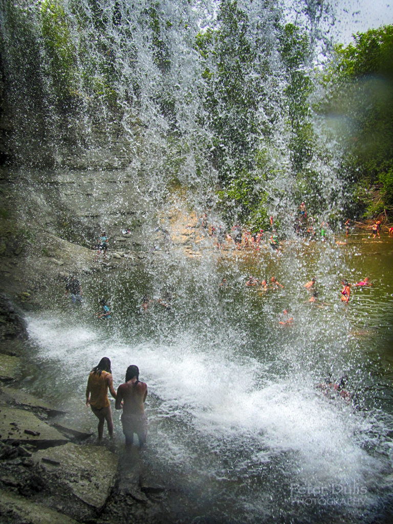
Bridal Veil Falls in Kagawong
Bridal Veil Falls is a short drive from the Cup & Saucer Hiking trails. The falls here have to be one of the prettiest plunge class waterfalls in Ontario. About 10-12m in height, the water falls over limestone and drops vertically into a pretty plunge pool at the base of the falls. It’s a great place to take a dip and take some photos from behind the falls. This photo was taken with my Canon D30 underwater camera at f/3.9 with an ISO setting of 200; exposure was 1/640 sec.
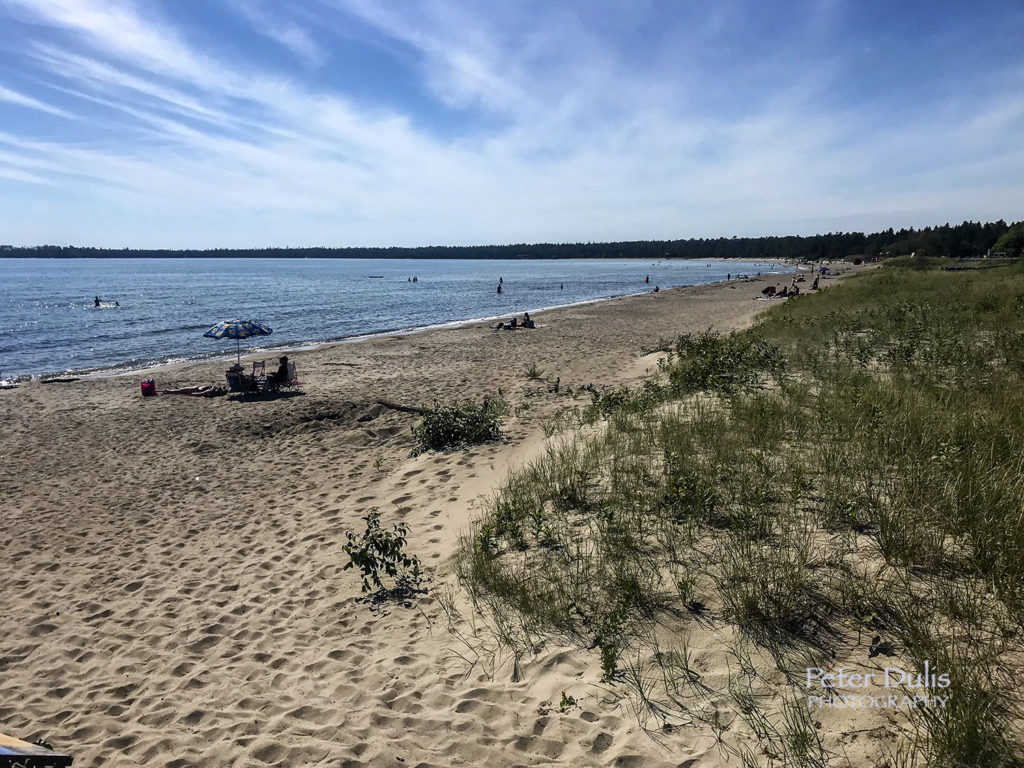
Providence Bay
Located on the south shore of Manitoulin and looking out upon Lake Huron, the crescent of golden sand is one of the Island’s top natural attractions, rated the “best” and the “longest” beach in Northern Ontario. It is renowned for its beautiful sandy beach with it’s sand dunes and an extensive boardwalk, which make for great photo opportunities. The water is shallow, so it’s great for families. This photo was taken with my iPhone; at f/1.8 with an ISO setting of 25; shutter speed of 1/6800 sec.
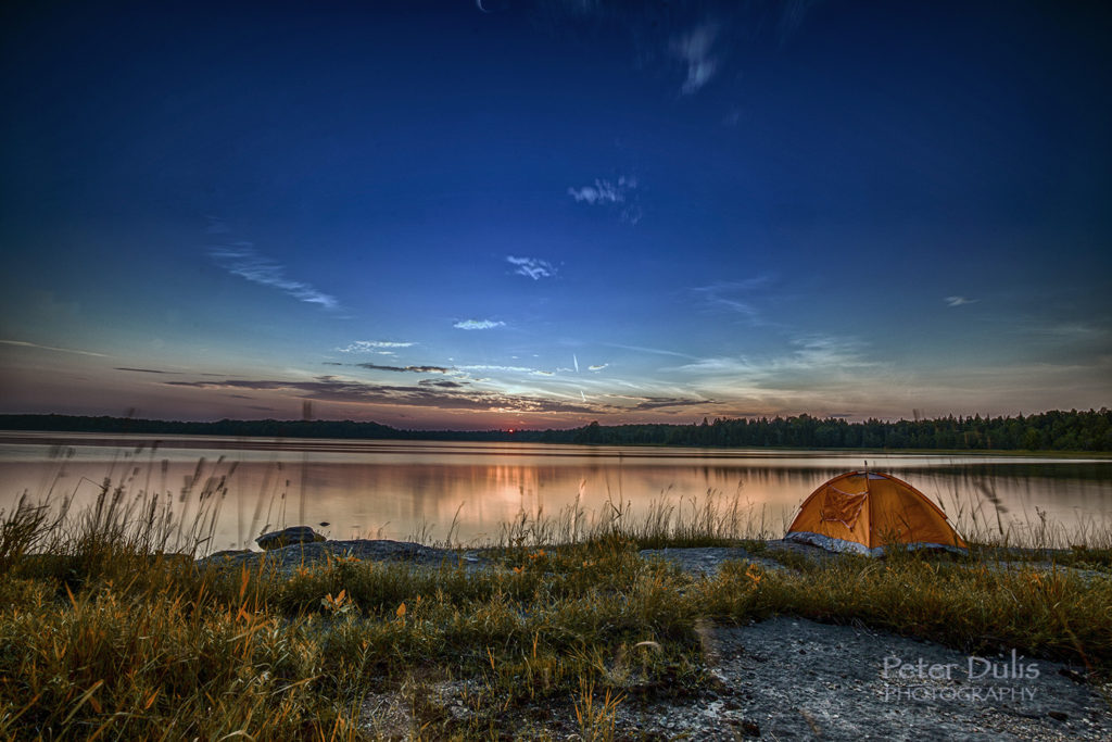
Manitoulin Island Lakes
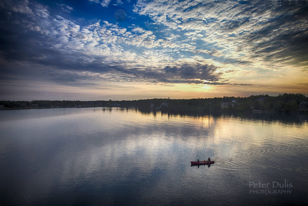
Manitoulin Island has a worldwide claim to fame with it’s many beautiful lakes. Most of the larger lakes have a striking turquoise blue color that make you feel like you’re in the Caribbean. There is also an abundance of fish for those who like fishing. If you’re picturing an oasis in your mind’s eye, it might be Manitoulin Island. This photo was taken with a 16-35mm lens; in manual mode; at f/11 with an ISO setting of 100; exposure was 30 sec., camera on tripod with a 10 stop ND filter.
Conclusion
There’s so much more to see and do on this beautiful island and we hope this blog may inspire you to go for a visit. We hope you enjoyed our photo adventures on Manitoulin Island and will stay in touch with us.
Travel & Photography Made EasyHere’s your chance to get your exclusive travel guide and photo tips in our 20 page e-book, along with regular travel tips delivered directly to your inbox.
Discover amazing places to visit and how to photograph them (for non techie people)
With over 325,000 readers, TripAdvisor has hailed us as being “In the Top 1% of Popular Reviewers” plus “Top Photographer” – having visited over “90 Cities” – so here are our TOP 5 places to visit before it’s too late!